


page 16 – PRINTABLE NOTEBOOK HISTORY OF MANTUA
Download the file in which we summarized the history of Mantua


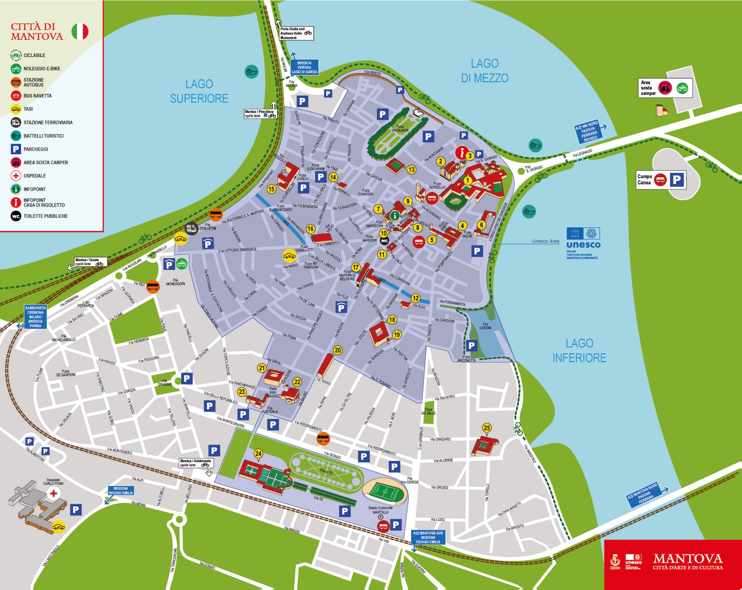
page 20 – CURRENT MAP OF MANTUA
Nowadays, maps are generally planimetric and represent a territory seen perpendicularly from above. An example are tourist maps, which are used to orient oneself in an unfamiliar city.
Here you can download the tourist map of Mantua.
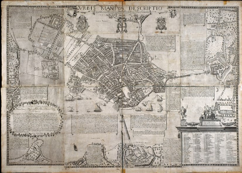
page 21 – HISTORICAL MAPS OF MANTUA
Urbis Mantuae Descriptio: Bertazzolo's map.
To view this map in the highest resolution possible, click on the image below: you will be able to see in great detail a representation of the city of Mantua as it was in 1628, when Bertazzolo drew it.
Other historical maps
On the site www.mantovafortezza.it , mainly dedicated to the presentation of the defensive works that have affected Mantua over the centuries, you can find a lot of information on the evolution of the city.
In particular, on the page www.mantovafortezza.it/documenti you will find a selection of the most significant historical maps of Mantua.

View the historical expansion levels of the city of Mantua here!
(Graphics by Muskan Abbas)
page 24 – ANCIENT MANTOVA, THE CIVITAS VETUS
pAug. 25 – MEDIEVAL MANTUA
page 26 – RENAISSANCE MANTUA – PART 1
page 27 – RENAISSANCE MANTUA – PART 2
page 28 – AUSTRIAN AND FRENCH MANTUA
page 29 – MANTUA TODAY
page 30 – PHOTOGRAPHIC ARCHIVE
Historical photographs. To discover the face of the city as it appeared in the recent past, you can consult the photographs found in the database of Sirbec, the Lombardy Region's Cultural Heritage Information System, which brings together the region's photographic archives in a single platform.